El Quseir – Top 10 Unmissable Sites
To book an excursion to El Quseir contact Steven via WhatsApp on +20 102 999 9978. Details given near the bottom of this page.
Nestled on Egypt’s Red Sea coastline, about a fifty minute drive (75 kilometres) north of Marsa Alam Airport, El Quseir emerges from the desert haze like a town suspended between memory and modernity. Home to around forty thousand residents, this ancient port – inhabited for nearly five thousand years – offers visitors a glimpse into a maritime heritage that stretches from pharaonic expeditions to Ottoman grandeur, from medieval pilgrimage routes to early twentieth-century phosphate mining and industrialization.
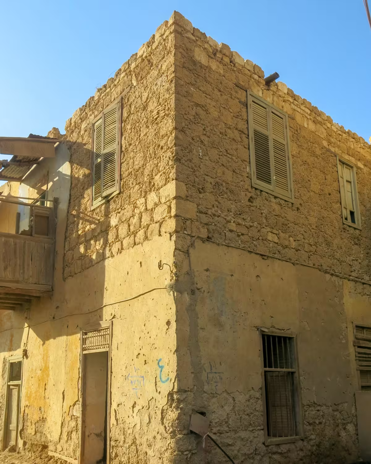
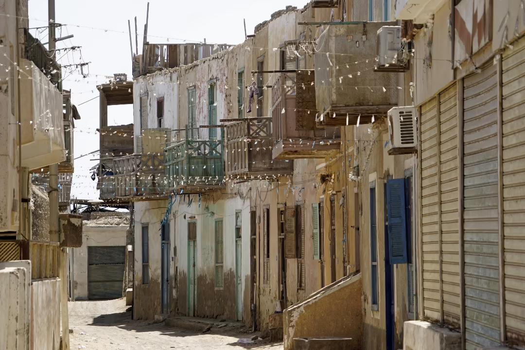
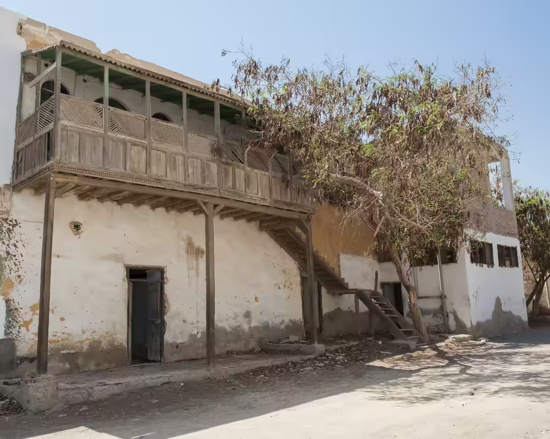
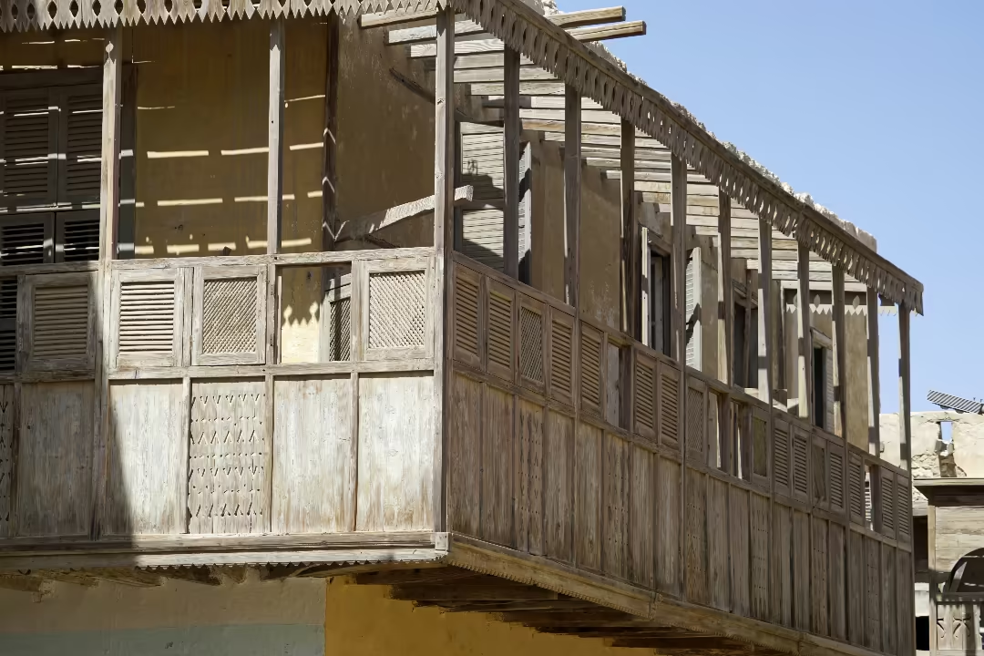
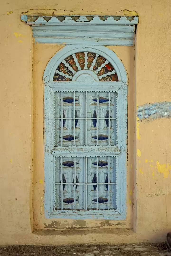
Where other Red Sea coastal towns have surrendered their character to mass-market tourism, El Quseir retains a rare and defiantly authentic sense of place. This identity is woven into the very fabric of its old town, a maze of narrow, shaded alleys and coral-stone houses. It is the only place in Egypt where so many buildings still display their original and distinctive “Red Sea style,” adorned with colourful doorways, wooden balconies and exquisite rawashines (also called mashrabiyas) – projecting wooden windows, with intricate latticework, that overhang the street.
The town’s name, El Quseir (meaning “the short”), references its strategic position at the terminus of the shortest route across the desert from the Nile Valley to the sea, a corridor for trade and faith for millennia. Its picturesque old town and fishing harbour still echo this past as a vital link between Egypt and the wider Indian Ocean world.
El Quseir’s charm lies in a visible stratification of history—a blend of Mamluk, Ottoman, Islamic, Coptic, and European colonial influences that have shaped its architecture, culture, and community. Here are ten places that bring this layered history vividly to life.
1. El Quseir Fort
ID 43619575 © Paul Vinten | Dreamstime.com
MWFP84/Shutterstock.com
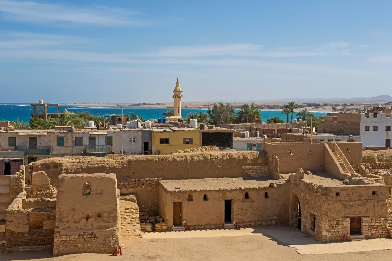
The Ottoman Fort stands guard over the heart of El Quseir. Construction began in or very shortly after September 1571 on the orders of Ottoman Sultan Selim II. It was designed for two vital purposes: to safeguard the strategic harbour from the growing ambitions of Portuguese traders competing for dominance of the Indian Ocean trade routes, and to protect the sacred Hajj pilgrimage route to Mecca, for which El Quseir was a principal departure port. The fort soon became a key military stronghold, reinforcing Ottoman authority over this essential link for both trade and pilgrimage between the Nile and the Red Sea.
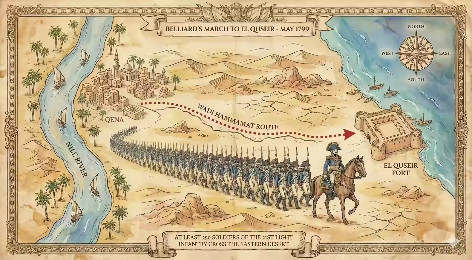
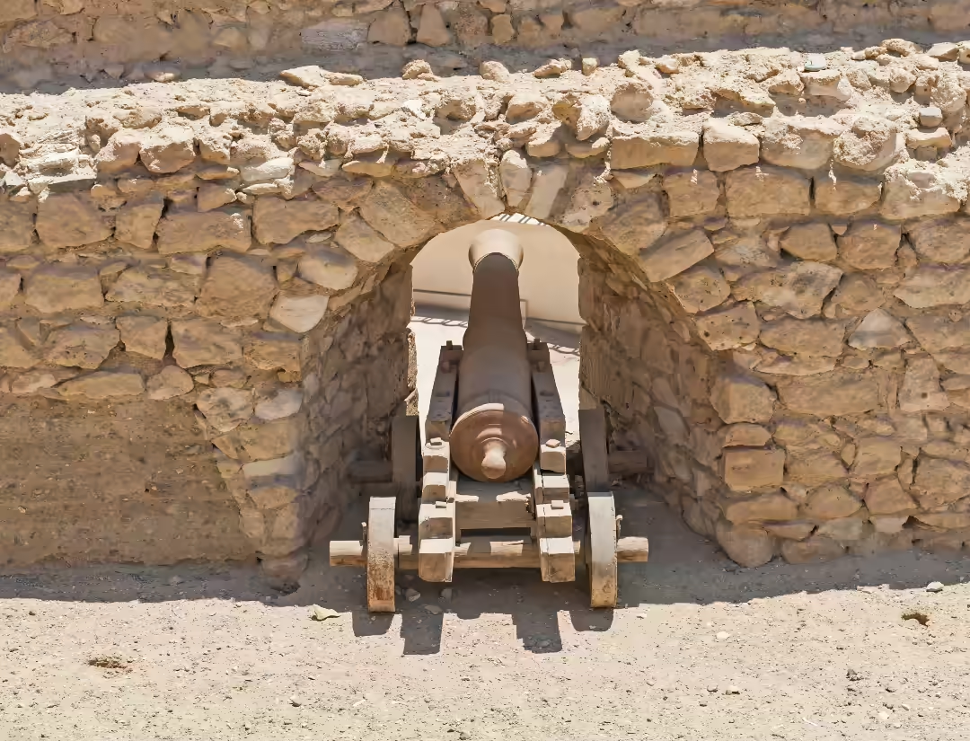
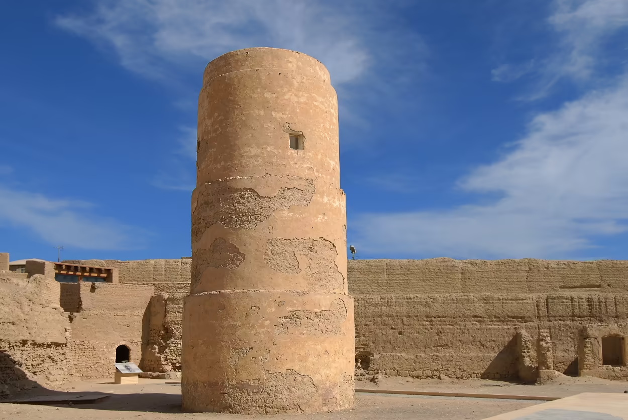
Its strategic importance was not lost on Napoleon Bonaparte. In May 1799, the newly appointed French governor of Upper (southern) Egypt, General Augustin Daniel Belliard, led a large French force from the Nile eastwards through Wadi Hammamat, a sun scorched arid valley which winds through the mountains of the Eastern Desert, and seized El Quseir and its fort without a single shot fired. He left a garrison of about 250 soldiers of the 21ème demi-brigade d’infanterie légère under the command of General Donzelot. The French quickly set about strengthening its defences, building a tall observation platform within its walls, widening the ramparts and adding a number of cannon, some of which can still be seen.
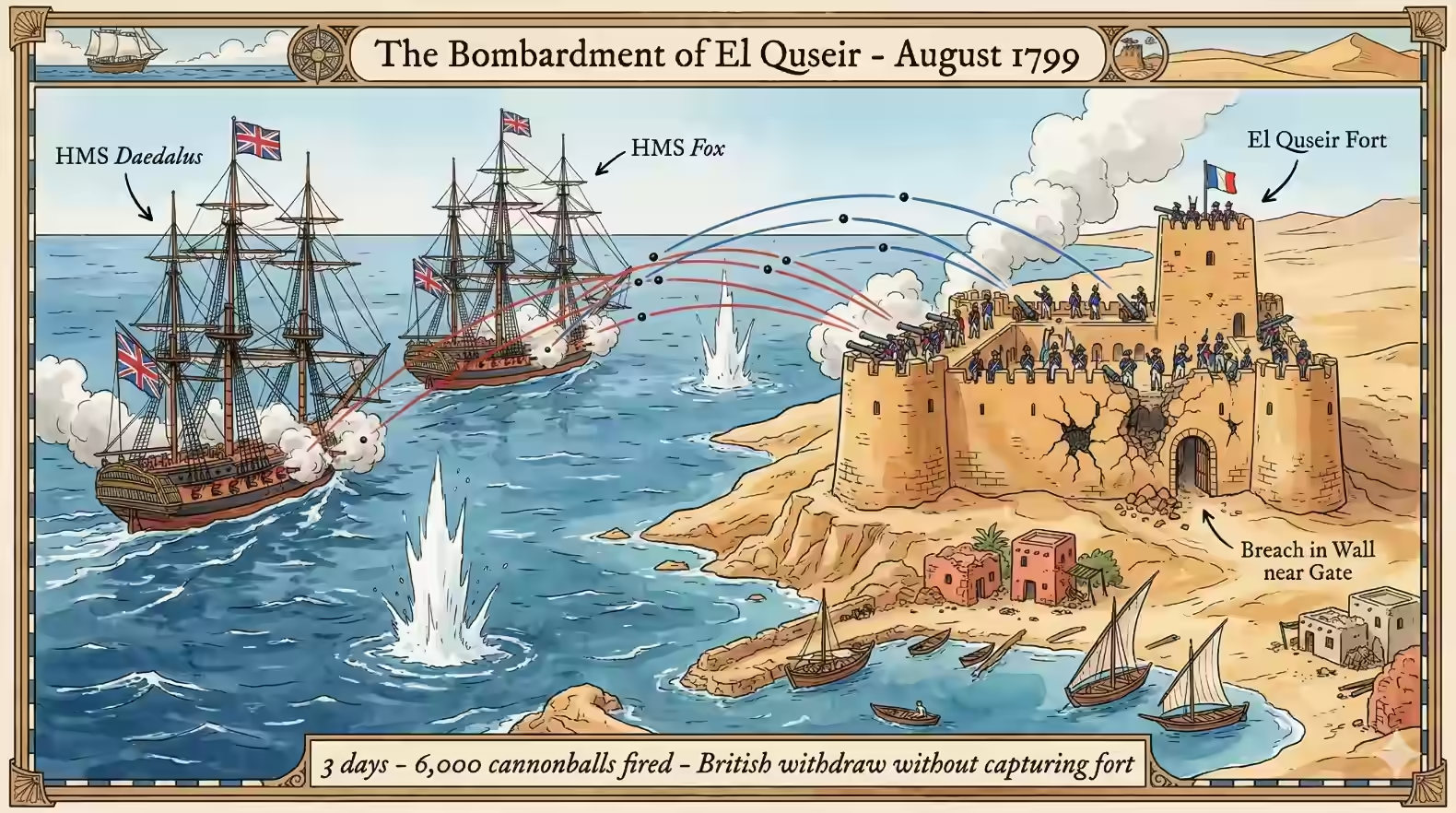
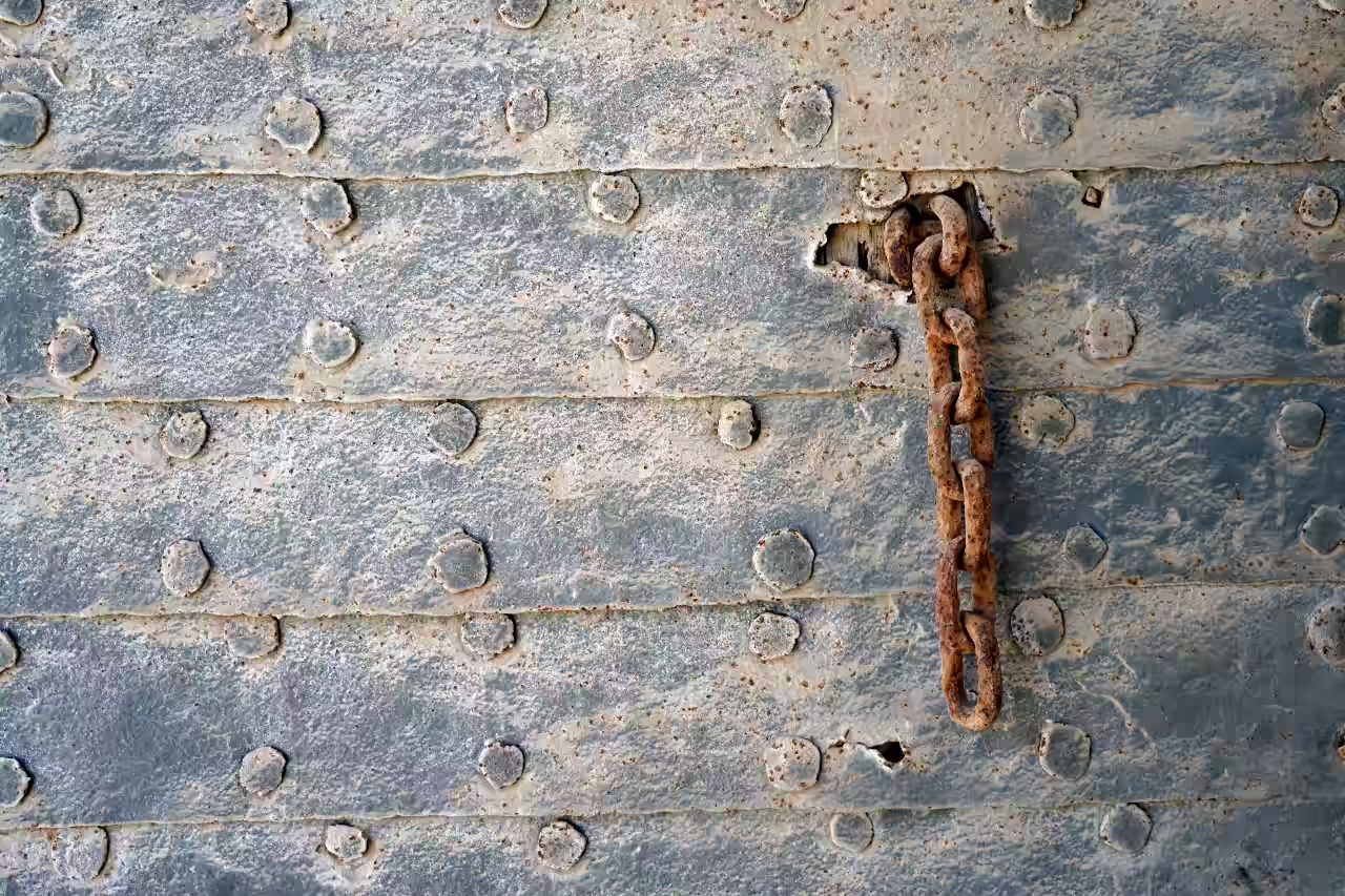
In August 1799, the fort’s reinforced defences endured a relentless three-day assault from two British 32-gun frigates, HMS Daedalus and HMS Fox, which unleashed an estimated 6,000 cannonballs upon it. Despite their eventual retreat, the powerful bombardment from these battleships left significant breaches in the walls, particularly near the main entrance. These were gradually repaired by Donzelot’s men over the next 22 months.
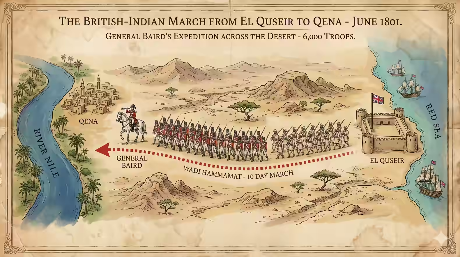
The fort was finally deserted by the French in June 1801 when a formidable force of around 6,000 British and Indian soldiers, led by General Baird, landed at El Quseir. Baird’s men then embarked on a grueling ten-day march across the Eastern Desert to capture Qena on the Nile. This remarkable achievement helped to hasten the final surrender of French forces in Egypt by September.
Paul Vinten/Shutterstock.com
Rob Atherton/Shutterstock.com
Both the town and the fort played a key strategic role again in 1816, when the Egyptian Ottoman Viceroy and de facto ruler Mohammed Ali instructed his oldest son, Ibrahim Pasha, to sail from El Quseir with an expeditionary force to resume the Ottoman-Saudi war, which had already seen Egyptian Ottoman forces seize Yanbu, Medina, Jeddah and Mecca in an earlier campaign between 1811 and 1813. . However, with the opening of the Suez Canal in 1869, El Quseir’s prominence as a major port waned, and the fort’s importance declined, though it seems to have taken on various roles including serving as a coast guard station until 1975.
The Fort’s Architectural Significance
Paul Vinten/Shutterstock.com
Paul Vinten/Shutterstock.com
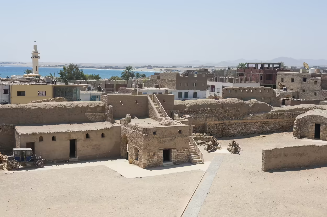
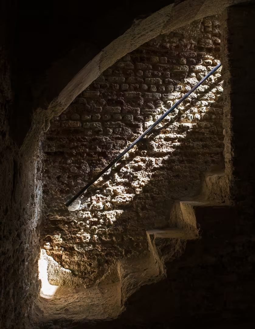
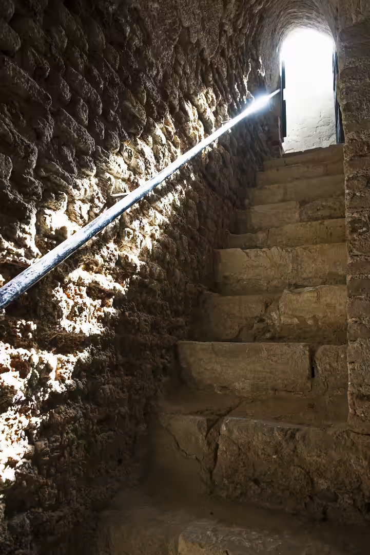
The fort is a robust example of Ottoman defensive architecture, subsequently modified by French military engineers. It is not a perfect square but rather a rhomboid, measuring approximately 75 meters by 75 meters. This shape was a deliberate choice, angling its key southeastern and northeastern defensive walls to better cover the coastline, while also aligning its principle gateway towards Mecca.1
© Paul Vinten | Dreamstime.com
© Paul Vinten | Dreamstime.com
© Paul Vinten | Dreamstime.com
The fort’s earliest design was straightforward but sturdy: limestone walls of about 150 centimetres thickness, flanked at each corner by four circular bastion towers. However, its appearance changed dramatically during the Napoleonic occupation, when French engineers reshaped it to cope with modern artillery.
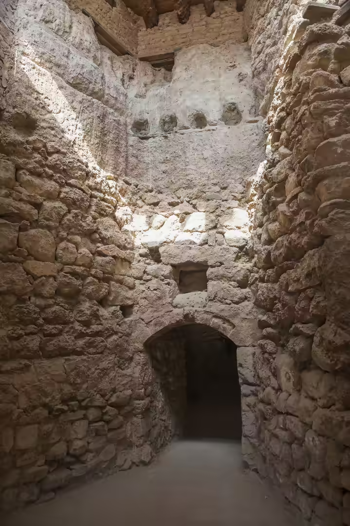
They incorporated the southern tower into a larger, sharply angled artillery bastion and built a triangular redan, essentially a defensive outwork, before the main gate to shield the entrance. Inside, they constructed heavy retaining walls, or contre-murs, packing the gap between these and the outer walls with rubble taken from the central courtyard. This created much thicker, more resilient ramparts. The final structure combined stone masonry with a concrete-rubble core: coursed rubble inside and neat, rusticated limestone blocks forming the exterior.2
Visitor Appeal.
MarsaAlam.com: AI gen using Google Gemini
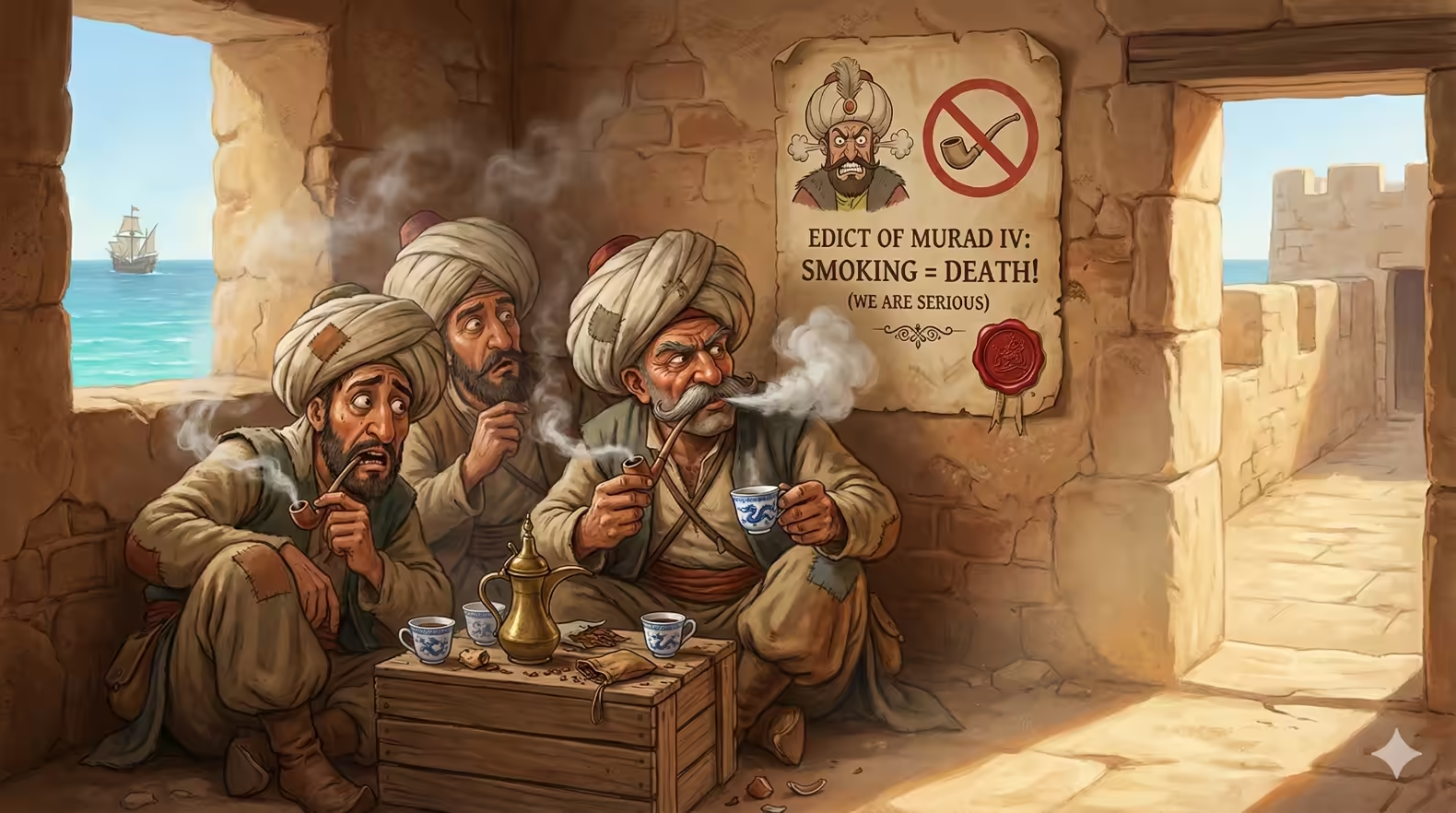
Following restoration (1996–2005) with USAID support, it now operates as a visitor centre with small, well-curated exhibits in the towers and casemate chambers, detailing local history, Bedouin culture, maritime trade, and the history of local phosphate mining. There is also a fascinating display of some of the artefacts found at the fort during archaeological and restoration work including “Ottoman tobacco pipes, Yemeni coffee cups and Far Eastern blue-and-white porcelain.”3 The evidence discovered at the fort also suggests that a smoking habit among soldiers at the fort likely persisted well into the seventeenth century, defiantly continuing even after Sultan Murad IV banned smoking in 1633 under penalty of death. (see El Quseir 23 Fascinating Facts.)
Rob Atherton/Shutterstock.com
Rob Atherton/Shutterstock.com
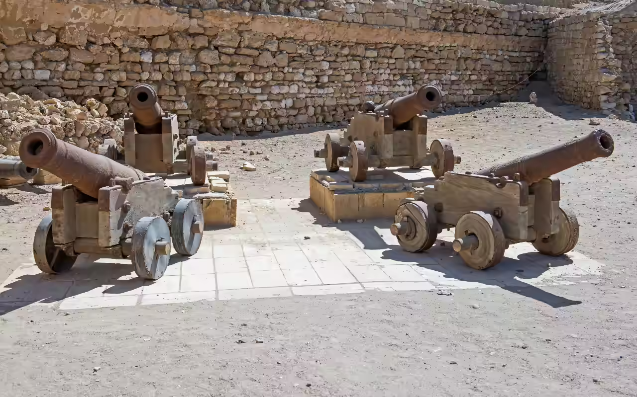
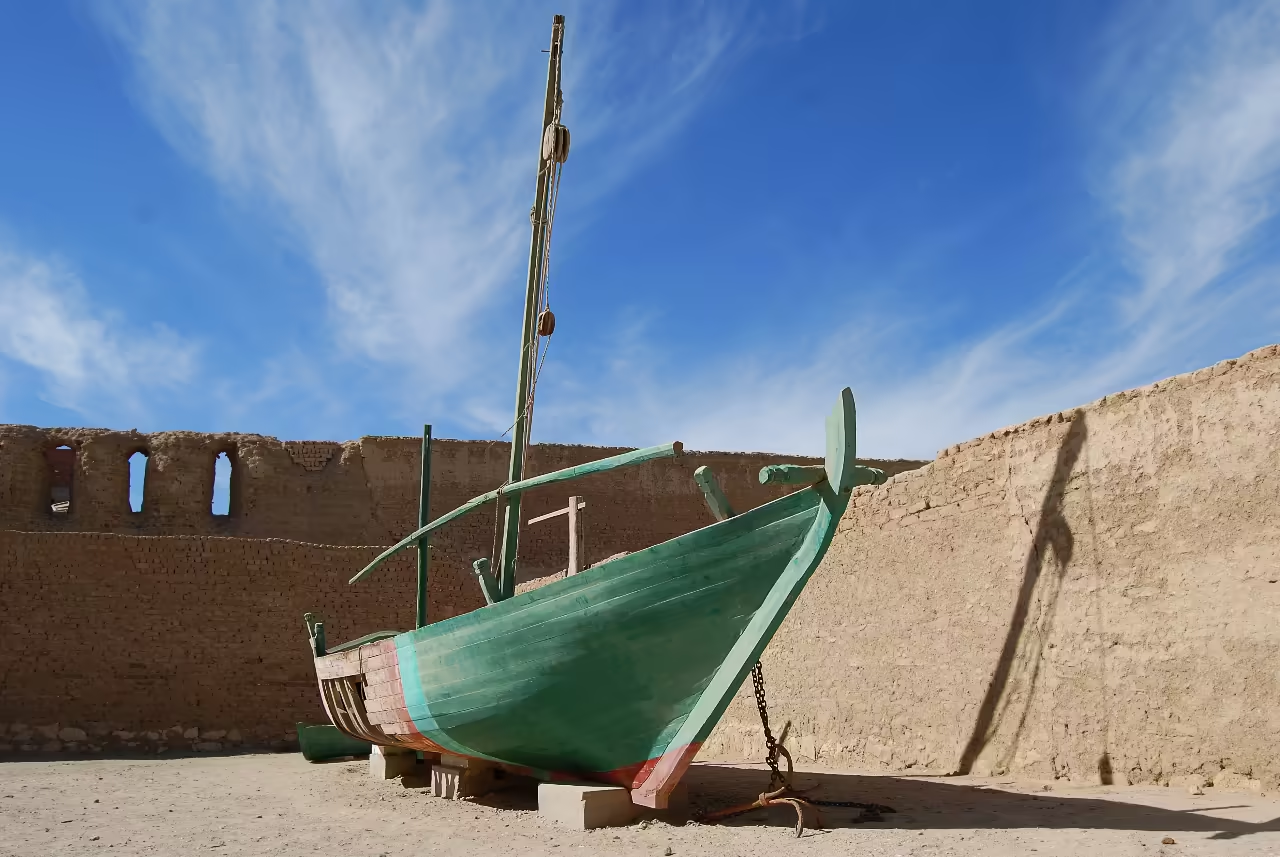
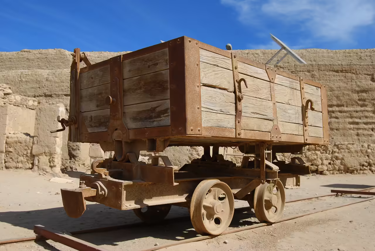
The open-air courtyard displays larger artifacts that tell the story of the town’s history, including original rail wagons from the Italian phosphate factory, a locally built pearl-diving boat, and a collection of six cannons, four in the main castle courtyard and two overlooking a main shopping street.4 These cannons, left behind after the Napoleonic conflict and classified by experts from the British Royal Armouries, include five eighteenth century French and Dutch/Swedish pieces and one British cannon which may have been captured from a failed British marine assault during a three day battle in August 1799.
The central watchtower offers breathtaking panoramic views over the red-tiled roofs of the old town and the expanse of the Red Sea. As of 2025, the fort is open daily from 9:00 am to 5:00 pm. An adult entry ticket costs 60 LE (Egyptian Pounds), with reduced rates for students, providing a valuable source of revenue for its ongoing maintenance.
2. The Shaykh Al-Farran Mosque
Paul Vinten/Shutterstock.com
ID 126777388 © Istomina Olena
Dreamstime.com
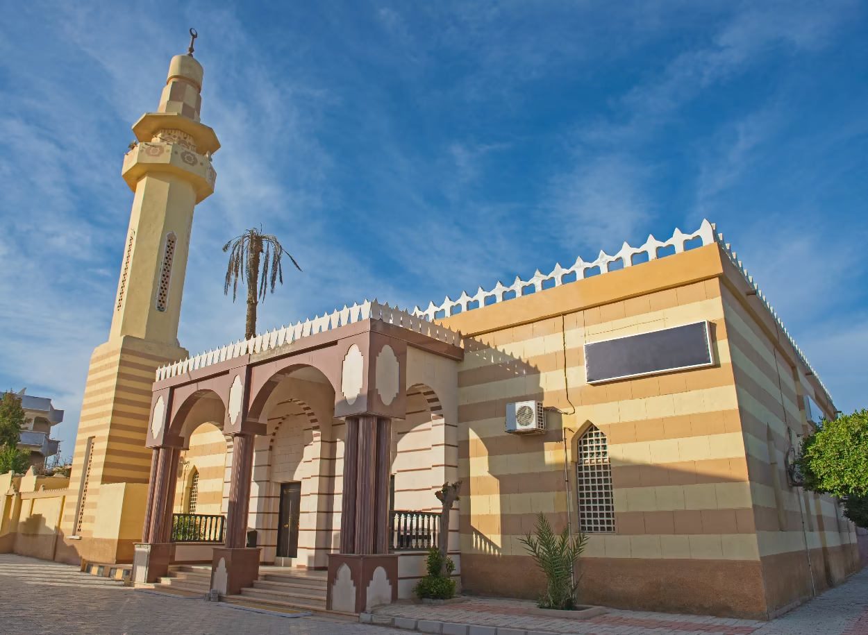
The Shaykh Al-Farran Mosque (also sometimes known as Al Furn mosque) is probably the oldest and most well known mosque and landmark in El Quseir, standing as a testament to the town’s strong Islamic pilgrimage heritage.
Located in the heart of the old town by the harbour, the mosque is named after Sheikh Al Farran, a revered figure who came from an Arab tribe in the Hejaz region of modern-day Saudi Arabia. Little is known about his life, but after his death, he was adopted by the local sailors and merchants as their patron saint, and his mosque became a focal point for the community. Its presence is central to El Quseir’s identity as a town of saints, where many pious pilgrims, including some who perished on their Hajj journey, are venerated.
From a book by A. Weigall via Wikimedia.
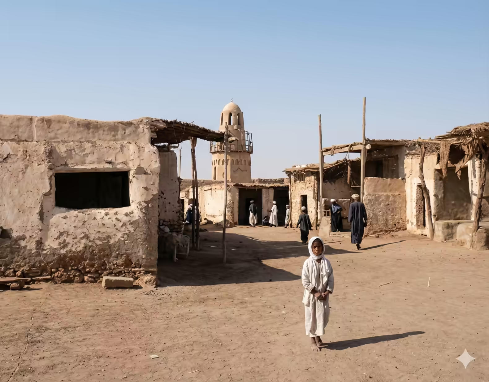
Image: MarsaAlam.com using Google Gemini AI.
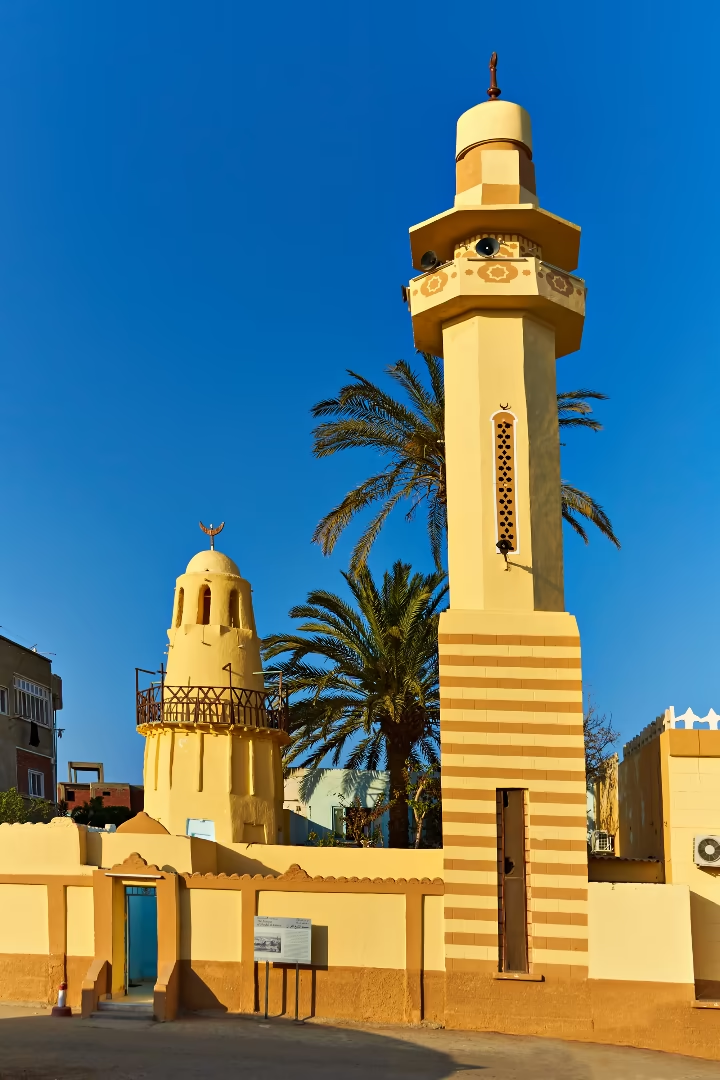
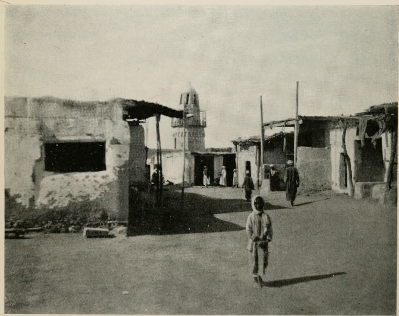
A historical inscription dates the construction of the mosque’s older and shorter minaret to 1116 AH (1704 AD). However, recent historical analysis, including studies of paintings from time of the French occupation, suggests this is not the original minaret. The original was likely a slender, pencil-like tower in the classic Ottoman style, similar to those in Cairo. The minaret that stands today, a more robust structure, is believed to have been built in the first half of the nineteenth century.
The original minaret served not only as a high point for the call to prayer but also operated a lamp which served as a beacon for ships approaching El Quseir. Its relatively tall height, wooden balcony and small domed top—finished with a crescent—made it easily recognisable from the sea by day and night, where sailors relied on it to judge their distance from the harbour. Positioned on the shoreline, it became both lookout and landmark, blending the call to prayer with the role of a lighthouse. It was also a gathering point for traders and pilgrims crossing the Red Sea, offering travellers an opportunity of quiet reassurance before continuing their journeys.5
© 7chriss3 | Dreamstime.com
© 7chriss3 | Dreamstime.com
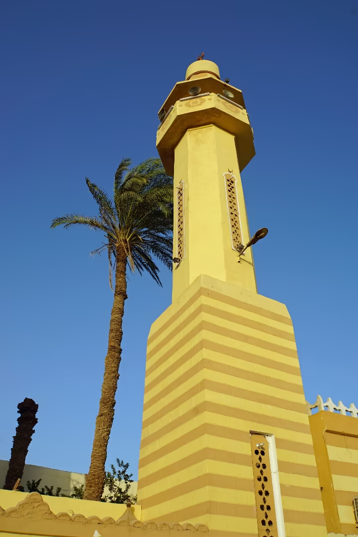
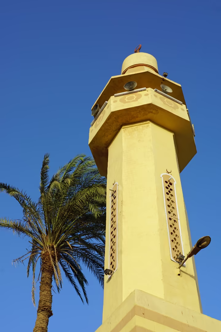
No one knows exactly what happened to the mosque’s first minaret. It may have weakened with age, or it might have been damaged—intentionally or not—during the Anglo-French fighting in Egypt between 1799 and 1801, when its role as a navigation marker could have made it a target. Fortunately, in 1980, a major restoration gave the mosque its new soaring minaret and reinforced the older nineteenth-century tower-like minaret that still stands today.
As a major cultural and tourist attraction, the mosque is open to all visitors, regardless of faith or gender, except during the five daily prayer times. Visitors are required to respect its sacred character by dressing modestly. Both men and women must cover their arms and legs, women must also cover their heads and shoes must be left outside before entering the carpeted interior.
3. The Old Town
For a detailed guide with many photographs see our Old Town Architecture page.
ID 251051606 © Yurii Borysov | Dreamstime.com
ID 413214938 © 7chriss3 | Dreamstime.com
The true soul of El Quseir is not contained within a single building but is experienced in the labyrinth of narrow lanes that constitutes its historic core. Walking along these alleyways feels like stepping into a living museum—a rare surviving example of a traditional Red Sea port town.
Urban and Architectural Significance
The layout of the old town reflects time-honoured Islamic design, using a dense, layered pattern of streets suited to life on the coast and shaped by centuries of adaptation to the climate. Its narrow close-set alleys are more than just picturesque—they offer welcome shade to protect pedestrians from the harsh sun while simultaneously funneling and accelerating the cooling breezes from the Red Sea.
© Paul Vinten | Dreamstime.com
ID 413215723 © 7chriss3
| Dreamstime.com
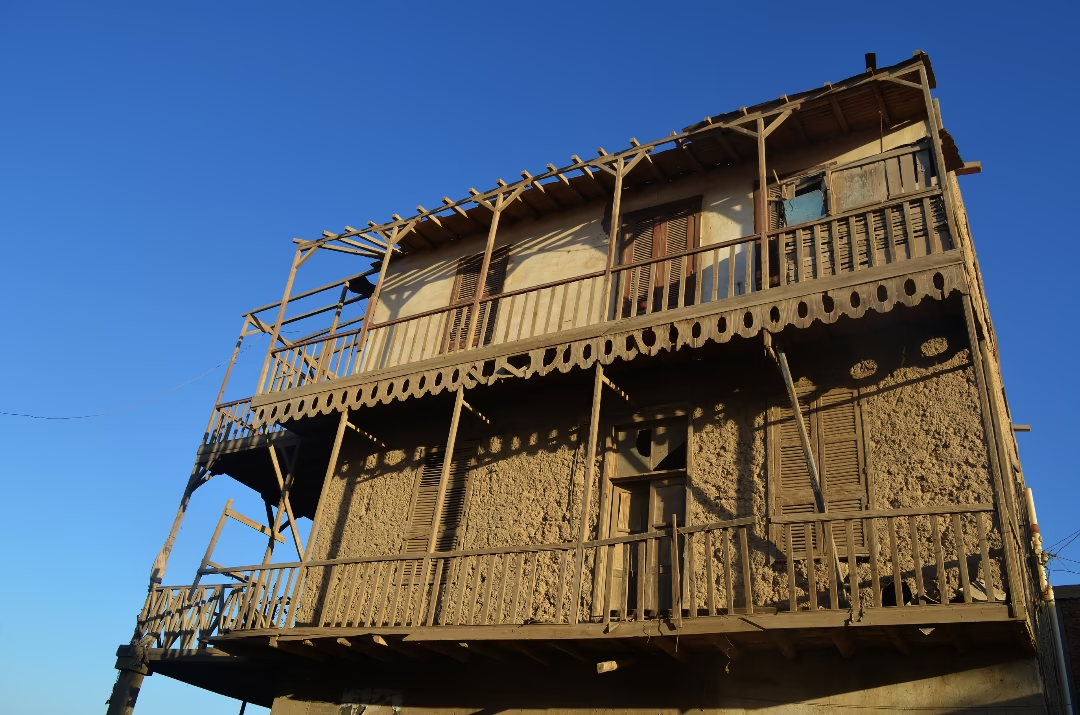
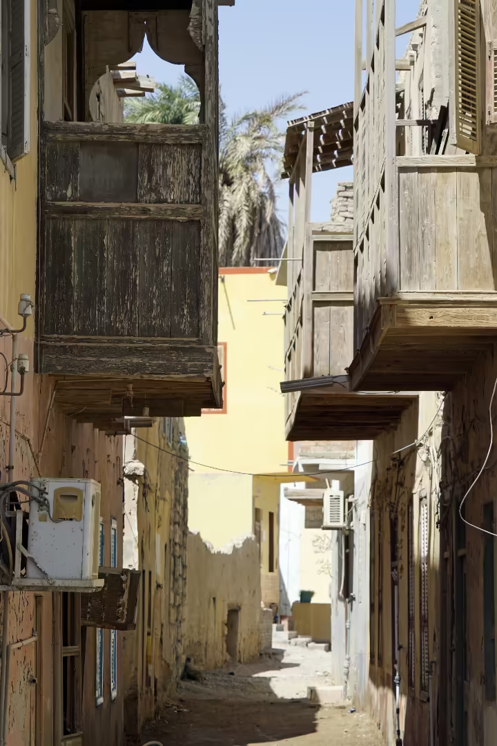
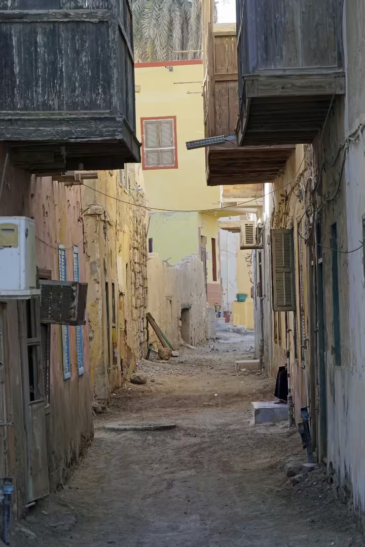
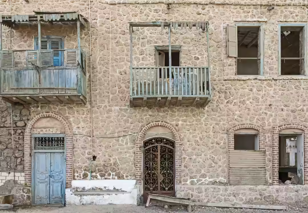
The alleys are hemmed in by houses hewn from coral blocks, their surfaces softened by decades of sun and sea air. Many of them with washed-out tones of yellow, blue and pink. The colours, sometimes peeling and flaking, seem to drift across the walls like memories more than paint. From above, wooden balconies and occasionally larger wooden window structures or rawashines jut outwards into the narrow streets.
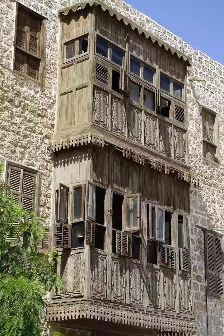
The rawashines (also known as mashrabiyas), with their finely intricate latticework screens, belong to an older rhythm of life. They diffuse the harsh midday sunlight, draw in the cooling sea breezes, and guard the privacy of the rooms within. In their quiet practicality, they speak of a town shaped as much by culture as by the coast that borders it.
ID 413215901
© 7chriss3 | Dreamstime.com
ID 413404699
© 7chriss3 | Dreamstime.com
ID 413224587
© 7chriss3 | Dreamstime.com
Cultural Significance
The intimate narrow alleyways means that almost all neighbours know each other, creating according to research student Manar Ahmed Al Gammal, “an interactive and intimate social environment among local residents.”6 The alleyways are also a canvas for the town’s social and spiritual life. Many of the brightly colored wooden doors are adorned with vibrant hajj paintings. These murals, typically depicting the Kaaba, an airplane or a ship, are a proud and public declaration that a resident has completed the holy pilgrimage to Mecca, reinforcing the town’s enduring link as historically a key stopping point for pilgrims on route to the Hajj.
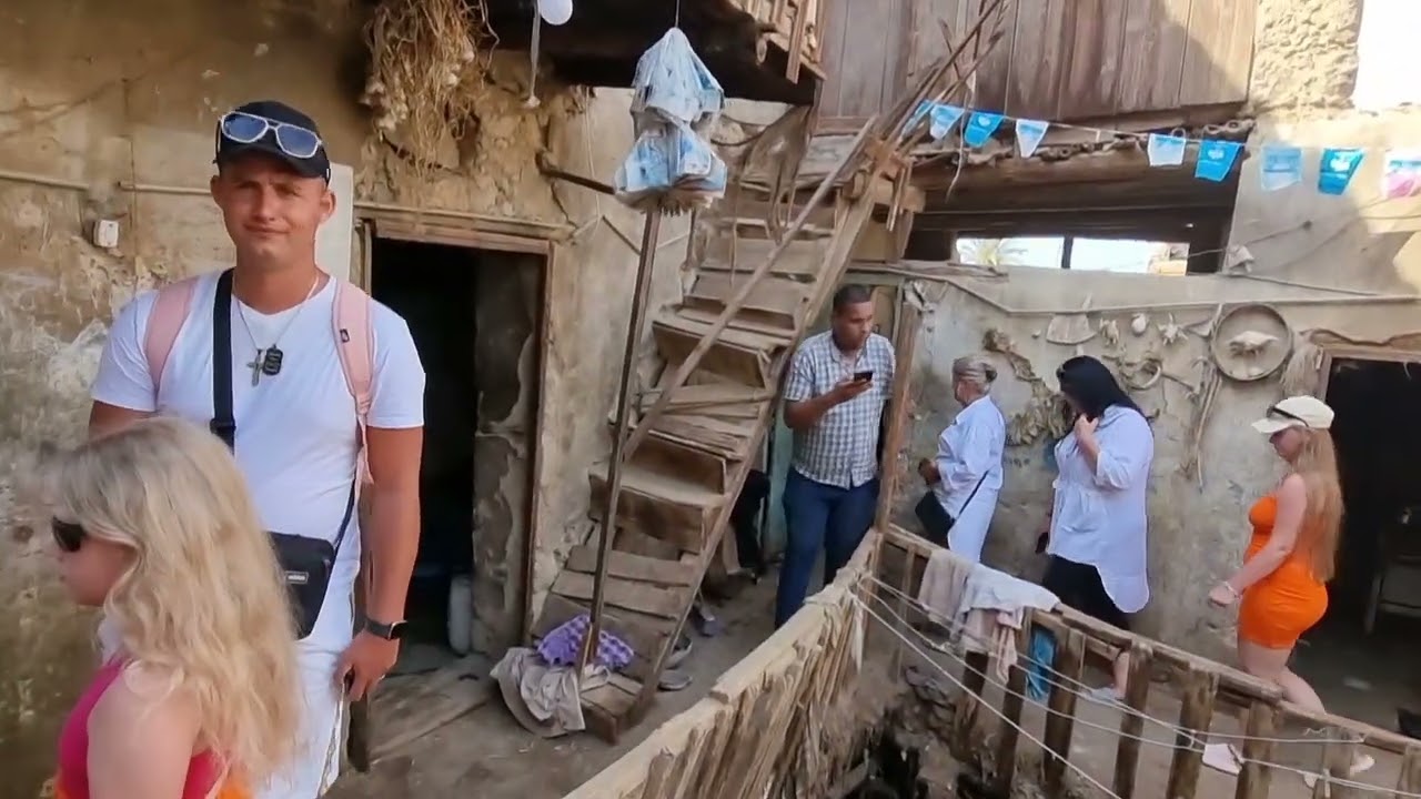
Some buildings in need of renovation.
17.05.2024 – 40m 55s 29+ likes – 4K+ views.
Current Condition and Conservation
The historic core has been in a precarious state of preservation for many years. Even as far back as 1997, one academic study concluded that “Over 70% of the buildings in the historic core are in average or bad physical condition” and that “more than 7% have either partially or entirely collapsed over the last decade.”7 And it seems that the situation since then has only worsened with a more recent study in 2023 noting “the deterioration of the urban structure of most areas in the buildings in the historic core,” while a visitor from Germany commenting on Tripadvisor, recently described the old town as “very neglected and dilapidated in many places.”8
Many other contemporary observers have also noted the advanced deterioration, describing it as a place fading away, where time seems to have forgotten to touch this place. The very material that gives the town its character is its greatest liability: the porous coral blocks are extremely vulnerable to salt weathering and water infiltration from the humid maritime air, leading to rapid decay and structural instability if not maintained.
Similarly, the roof joists fashioned from palm trunks and imported timber demonstrate sophisticated joinery and decoration, but they are also highly susceptible to marine-environment decay, fungal growth, and termite damage. Unfortunately, sufficient funding for repairs is lacking and most of the residents have abandoned the older buildings of the old town to migrate to the north of the city.9 Without a significant funding intervention from government or NGOs, the town’s historic core seems to be trapped in a vicious cycle of deterioration and abandonment.
Visitor Appeal
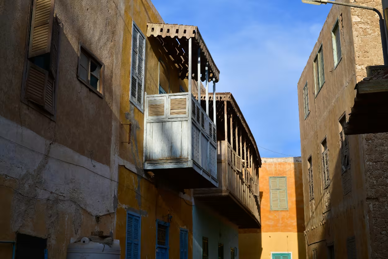
Photo: Sarah C. Murray, CC BY-SA 2.0 via Flickr
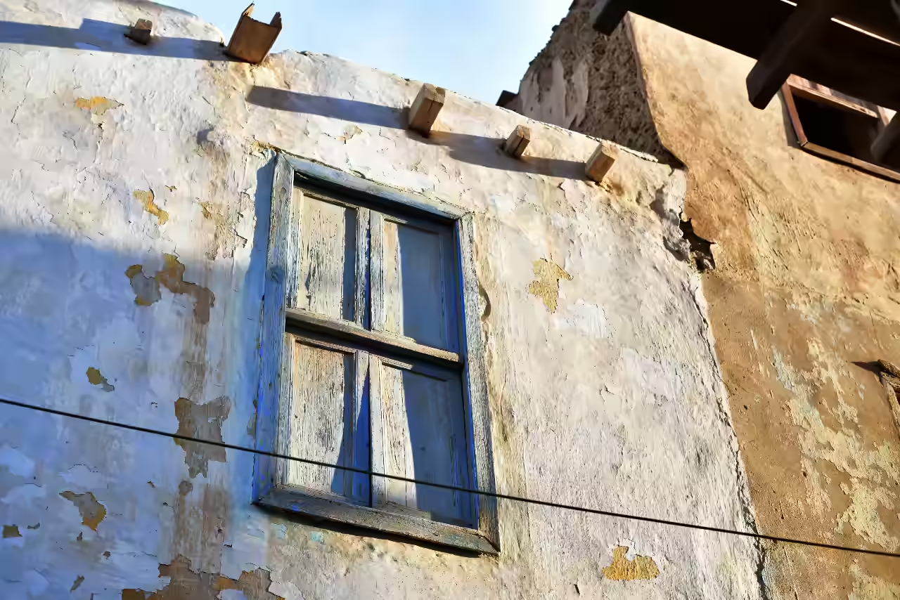
Photo Sarah C. Murray – CC BY-SA 2.0 – via Flickr
El Quseir’s real magic is found not in museums, but in the atmospheric alleys of its historic core. This old quarter is a place to get lost in, where the layout itself tells the story of its past as an ancient port for pilgrims and merchants. Wandering these narrow alleys, you are surrounded by homes built from local coral stone, their faded yellow and blue facades testifying to centuries of sun and sea air.
Unlike its glossier neighbours, El Quseir feels authentic and untouched. Amidst these weathering facades, the visitor discovers a sleeping beauty—a historic port that, though under threat from neglect and deterioration, has until now somehow survived to offer a rare window into the Red Sea’s unique architectural heritage.
4. Sheikh Tawfik House (El Quseir Hotel)
ID 165296295 © Karelbittner
| Dreamstime.com
ID 413404609 © 7chriss3
| Dreamstime.com
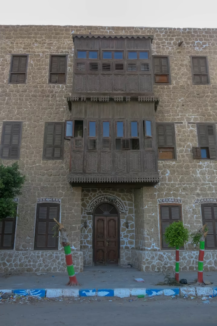
The Sheikh Tawfik House, located on Port Said Street looking east across the Red Sea and right next to the public beach, is arguably the most beautifully preserved and celebrated example of El Quseir’s domestic architecture, serving as a powerful symbol of successful, community-focused conservation.
This grand house, dating to the 17th-19th centuries, was the residence of Sheikh Tawfik, who held the esteemed position as chief of one of the local mosques. The house stands as a prime example of the type of dwelling built by the town’s affluent merchants and community leaders during the
Ottoman period (from 1571 when the construction of El Qusier fort enabled the establishment of the new port to 1914).
Architectural significance
The house is built in the traditional style, using coral blocks and wooden beams, with multiple stories reflecting the original owner’s high status. However, the building’s most distinguishing feature is its impressive and intricate overhanging wooden latticed balcony that covers nearly one-third of the main façade. This rawshan (also often called a mashrabiya) is an iconic element of Red Sea architecture, designed for shade, airflow, and seclusion. It is also one of the best-kept examples in the region and its superbly preserved condition has made the building one of the architectural highlights of the old town and one of the most photographed landmarks.
It Conservation and Adaptive Reuse
Sheikh Tawfik House was rescued after more than twenty years of abandonment, thanks to a restoration project that set out to revive both the building and local craftsmanship. Instead of bringing in outside companies, the Renovation and Ecological Center of Quseir (RECQ) hired local residents, giving the community a direct role in protecting its heritage. The work relied heavily on traditional construction. An elderly Quseir master builder, one of the few still familiar with the old methods, repaired serious cracks in the thick walls using stones and plaster similar to the original materials. He even trained his younger family members during the process, passing these vanishing skills to a new generation.10
Woodwork restoration became one of the most remarkable parts of the project. A former fishing-boat carpenter applied his craftsmanship to the house’s delicate architectural features. The rawshan, with its intricate but fragile woodwork, was restored without moving any of it to avoid damage while windows and doors were taken to a workshop for treatment that preserved their decorative details, though unfortunately the seriously deteriorated main staircase had to be rebuilt from scratch.11
Finally, to prepare the building for use as a three-star hotel, workers installed modern essentials such as bathrooms, air conditioning, and fire alarm with materials and equipment had to be brought from Hurghada or Cairo. The result, when the work was completed after a year, was both a welcoming hotel and a superb working example for future restoration work.12
5. The Seafront Corniche (Port Said Street)
Paul Vinten/Shutterstock.com
Paul Vinten/Shutterstock.com
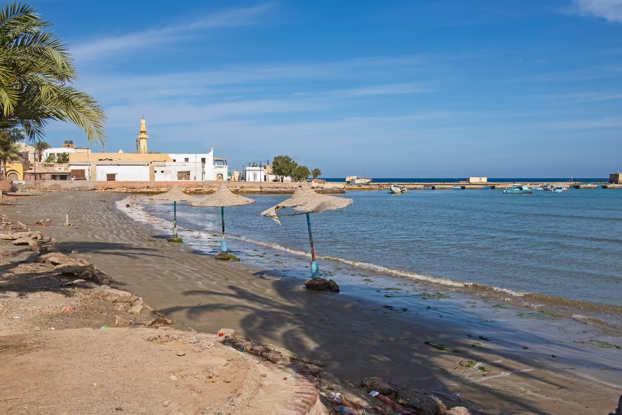
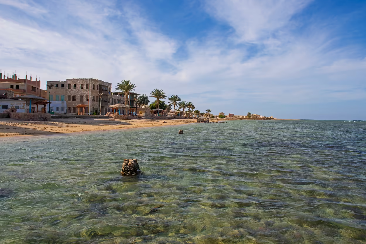
The Seafront Corniche, officially Sharia Port Said (Port Said Street), is the social and scenic artery of El Quseir, defining the town’s eastern edge, a poetic meeting point of the desert, the town, and the sea. For centuries, this coastline was the town’s raison d’être. It was here that Hajj pilgrims gathered to board ships for Jeddah, and where goods from the Nile Valley were loaded for export, including grain for the holy cities of Mecca and Medina, and spices from India were unloaded.
ID 214365865 © Paul Vinten | Dreamstime.com
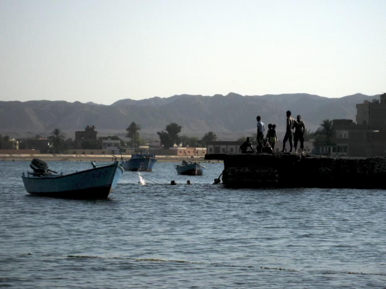
Photo: DrTH80 via Flickr CC-BY-SA 2.0
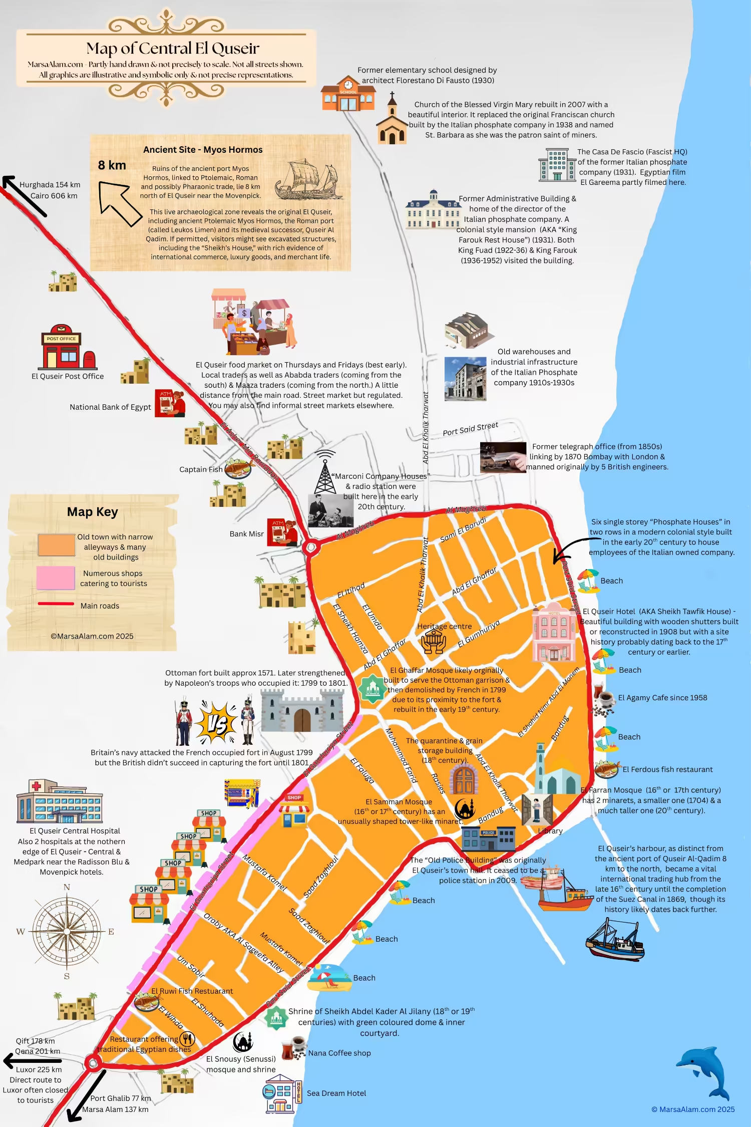
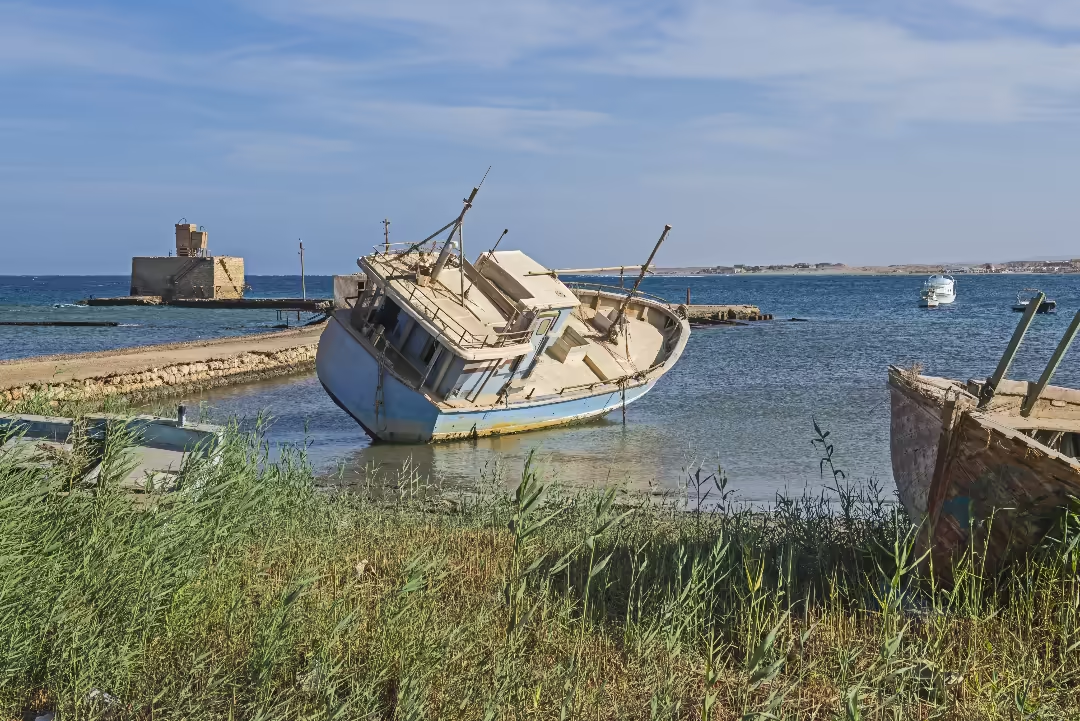
The Corniche is the central spine of the heritage area, linking many of the most important and interesting sites; the Old Police Station, the Quarantine Building and the Shaykh al-Faran Mosque are all located directly on or just steps away from this street (see the map). It also runs past the bustling fishing harbor, where visitors can observe the daily routines of local fishermen and their traditional wooden boats and where groups of children can often be seen swimming off one of the piers.
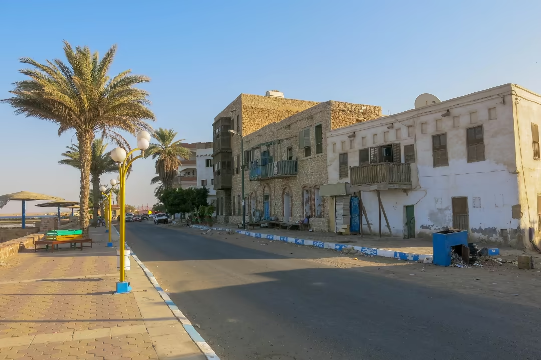
Sheikh Tawfik House has the impressive wooden rawshan.
ID 165296459 © Karelbittner | Dreamstime.com
ID 214552804 © Paul Vinten | Dreamstime.com
Port Said Street is lined with beach cafes and seafood restaurants with access to the stretch of public beach that runs the entire length of it (except for the harbour), making it a popular spot for both occasional tourists and a few Egyptian families seeking leisure and sea views. Could it be improved? Yes. It would be great to see the corniche fully pedestrianised and more investment in maintaining and renovating the nearby traditional coral built buildings, many of which are showing serious signs of aging due to the fragile building materials used and the corrosive marine environment.
For many visitors, a stroll along the Corniche form the most memorable moments of a visit to El Quseir. Life moves at a slower pace. It offers the best, most direct views of the Red Sea and is the ideal perspective from which to get a feel for the real Egypt in a tranquil, authentic setting. Walking the
Corniche, particularly in the late afternoon, allows a visitor to absorb the town’s maritime atmosphere, watch the fishing boats return, and if you walk out along one of the piers and take a look back, appreciate the skyline of the old town, anchored by the Ottoman fort and mosque minarets, and the mountains in the distance.
6. Quseir El Qadim
Located approximately eight kilometers north of the modern town and close to the Mövenpick Resort lies Quseir al-Qadima (“Old Quseir”) , the archaeological site of the original port city and the location of the town for over 80 per cent of its three and half thousand year history.
Historical Background
This site is widely identified by archaeologists as a major Ptolemaic, Roman and Medieval port. In the Ptolemaic period the port was known by its Greek name, Myos Hormos, which has been variously translated as either Mussel or Mouse Harbour.13 If it was the latter, it’s likely that this name stemmed from the abundance of mice or rats that would have swarmed the port, drawn by the grain and other foodstuffs stored on the ships or nearby.
During Roman rule, when the port adopted the Roman name of Leukos Limen (White Harbour), it was one of the most important gateways for the empire’s lucrative trade with India, Arabia, and Africa, a bustling entrepôt for silk, spices, and incense. Its history may stretch back even further; some historians think this might have been the Pharaonic port Tja or Tjau, from which Queen Hatshepsut’s fabled fifteenth-century BC expedition to the Land of Punt was launched.14
After the Roman period, the port was revived from the twelfth to the fourteenth century during the Ayyubid and Mamluk Islamic dynasties. It once again became a critical hub, serving as a primary departure point for Hajj pilgrims and as the terminus of the desert road from Qift (the nearest town on the Nile River), used to ship vital grain supplies from the Nile Valley to Mecca and Medina. The port’s prosperity ended when the harbor irreversibly silted up, likely in the fifteenth or early sixteenth century, leading to its final abandonment. This event precipitated the founding of the “new” town of El Quseir at its current location, centered around the Ottoman Fort.
Archaeological Significance
For centuries, the precise location of Myos Hormos, described by ancient historians, was a mystery. Its rediscovery and subsequent excavation by teams from the University of Chicago (1978–1982) and the University of Southampton (1999–2003) have yielded some of the most important finds in maritime Red Sea history, which are also crucial to an understanding of Egypt’s strategic and economic importance in the ancient and medieval worlds.15
The University of Chicago team excavated a thirteenth century mercantile complex known as the “Sheikh’s House” (not to be confused with Sheikh Tawfik House in the modern town). This warehouse revealed a treasure trove of over 1,400 fragments of Arabic documents written on paper. This archive provides an unprecedented, detailed look at the medieval Indian Ocean trade. The texts include shipping notes (mentioning vessels like the Good Tidings), business
letters, account records, school texts, poetry, and even zodiac charts.
They detail a thriving trade in textiles, dates, grains, perfumes, and luxury goods like Chinese porcelains, with distant ports as far away as Yemen or India. Specialist analysis of botanical remains from the site also shows the merchants enjoyed a wealthy diet of Nile Valley produce, such as grapes and watermelon, supplemented by expensive imports like Mediterranean nuts and medicinal plants from as far away as India.16
Visitor Appeal
Today, the ruins of Quseir al-Qadima are located adjacent to the Mövenpick Resort. It is an active archaeological site, so you should check first whether permission maybe needed to enter, appealing primarily to visitors with a deep interest in Roman, medieval Islamic, and maritime history. While the visible remains consist mostly of the excavated stone foundations of the warehouse and residential complexes, they represent a direct link to the ancient global trade routes that first put El Quseir on the world map.
7. The Italian Phosphate Company Complex
ID 28409755 © Maudanros | Dreamstime.com
ID 27721371 © Maudanros | Dreamstime.com
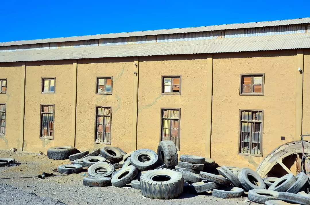
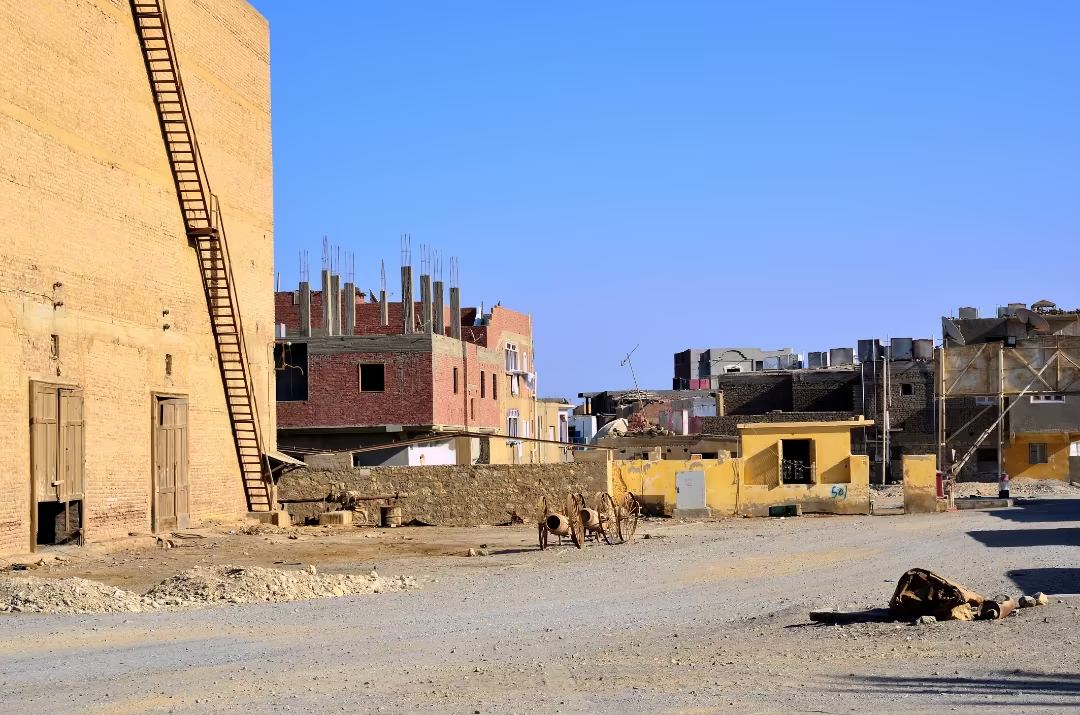
The vast, derelict Italian Phosphate Company complex at the northern edge of town is a haunting monument to El Quseir’s 20th-century industrial renaissance and subsequent decline.
After the Suez Canal opened in 1869, El Quseir’s economy collapsed. It was revived in 1912 when Italian entrepreneurs founded the Società Egiziana per l’Estrazione e il Commercio dei Fosfati, which began full-scale operations around 1916. This phosphate mining and processing industry brought a new wave of prosperity and a “Little Italy,” albeit with strong fascist colonial overtones, to the Red Sea coast, with phosphate mines in the surrounding mountains and a phosphate processing plant and export facilities based at the town itself.17
A large community of Italian engineers, technicians, and workers lived and worked here, fostering a period of surprisingly successful integration with the local Egyptian population. The company was nationalized by the Italian state in 1927 and later by the Egyptian government after 1956. Production was eventually shifted to more modern plants, and the El Quseir coastal facility was shut down for good in 1998, leaving a “vacuum” in the town’s economy and identity.18
The defunct complex occupies a large swath of land to the north of the old town, some of it along Abd El Khalik Tharwat Street (see map.) It consists of a sprawling landscape of dusty buildings, silos, and rusting machinery. The site also includes associated infrastructure built by the company, such as technician and worker housing (dating from circa 1906-1920) on the sea front, and the only church (see Site 10) for at least 100 km in any direction, originally built for the company’s Catholic employees but then demolished and rebuilt in 2007 in a similar style for the Coptic community, with a beautifully decorated interior.
Among the other notable buildings close to the church is the Administrative Building: a large, elegant two-storey colonial-style mansion with square corner turrets linked by broad, porticoed passages and graceful archways, built in 1931. Once serving as the director’s residence and accommodation for distinguished guests, it is even thought that King Farouk himself may have stayed here.
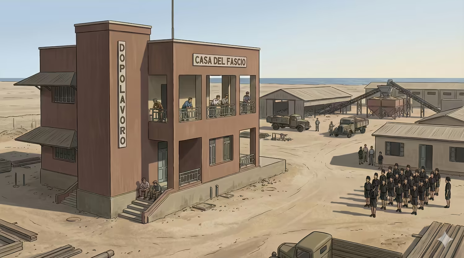
Image: MarsaAlam.com AI gen using Google Gemini.
Also not far from the church, but closer to the shoreline (see map), stands the Casa del Fascio (House of Fascism), built in 1933 and originally housing a canteen and workers’ recreation club. Many years later, in 2022, its austere architecture provided a bleak and foreboding backdrop for the Egyptian film El Gareema (The Crime). Another unusual sight for visitors would have been children in Balilla uniforms, attending the local elementary school, with breast pockets and stiff, integrated collars that mimicked the style of the Fascist Blackshirt militia.
Visitor Appeal
The abandoned plant has become a remarkable open-air museum. It is not an official tourist site, but tourists can typically gain permission from any guards at the entrance to wander around the derelict structures, while the church itself is sometimes included on some official site seeing tours. The appeal is atmospheric, eerie, and historical. Visitors can explore the abandoned offices and workshops, finding fascinating relics from a bygone era such as vintage scales, furniture, and refrigerators left behind. It is a powerful, tangible link to the industrial age and the personal histories of the many Egyptian and Italian families who built the modern town.
8. The Old Police Station
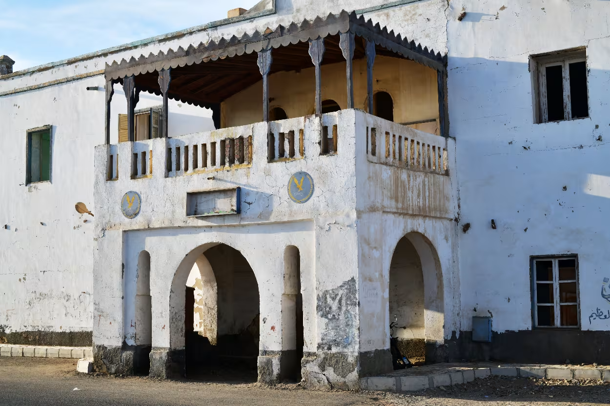
Positioned prominently on the seafront corniche adjacent the harbour, the Old Police Station is one of El Quseir’s most picturesque and evocative historic landmarks, though it is in need of restorative work.
Historical Background
This structure is far older than its twentieth-century name suggests, with its construction likely dating back to the early nineteenth century reign of Muhammad Ali. Its prime location overlooking the harbour hints at its original high status. Historical sources suggest it was built not as a police station, but as an Ottoman diwan (council chamber) or a customs house, controlling the goods and people passing through the port. It may have also served as
the city hall before being converted to its final use as a police station.
The two-story structure is organized around a central open courtyard, a common feature that provided light and air circulation. It was built to be robust, and its remains still project an air of former authority.
Current Condition and Conservation
Today, the Old Police Station is, to cite Lonely Planet, a “picturesque but dilapidated shell.”19 It is in an advanced state of deterioration and in urgent need of a careful restoration programme.20
There have however been significant efforts to save the Old Police Station. USAID (the United States Agency for International Development) has identified it as an important historic building and heritage site so possible future developments might include its adaptive reuse as a potential archaeology and ecology museum or a cultural centre. While these plans have not yet been fully realized, the building is recognized as a high-priority site for rehabilitation in any future conservation plans for the historic core.21
9. The Quarantine Building
The massive, fortress-like Quarantine and Grain Storage Building is located behind the Old Police Station, just a two minute walk from the Harbour. Sometimes referred to by its Ottoman/Turkish name Karntina, it is a powerful monument to El Quseir’s past as a gateway to Mecca.
This imposing structure is inextricably linked to El Quseir’s centuries-long role as a major Hajj (pilgrimage) port. Its current construction dates to the late Ottoman period, between 1775 and 1801.22 The quarantine was already in existence earlier but according to the Scottish landowner and traveller James Bruce who passed through El Quseir in 1769, it was then simply “a large enclosure with a high mud wall.” He also explained that “within, every merchant has a shop or magazine for his corn or merchandise.”23
One of its two primary functions was to serve as a quarantine station for pilgrims traveling to or returning from the Hejaz. This was a critical public health measure, primarily intended to prevent the spread of infectious diseases, most notably cholera, which was a constant threat along the pilgrimage routes.
However, the building also served a secondary, equally vital function as a shuna, or granary. It was used to store the vast quantities of wheat and grain transported from the Nile Valley. This grain was often an official subsidy from the government in Cairo, sent as a gift to the Holy Cities of Mecca and Medina, further cementing El Quseir’s key role in the religious and political life of the region.
Architectural Interest
The building’s most striking feature is its fortress-like facade “with no openings except for the entrance.”24 It is a large, robust, and functional structure, built with traditional bearing walls of rubble stone and wooden structures, including palm tree trunks and designed for security and large-scale storage. A unique architectural detail is the small mosque, Al Saman Mosque, that is incorporated into the building’s outer perimeter, and allowed pilgrims to fulfill their religious duties while in quarantine.
Current Condition and Conservation
Like the nearby Police Station, the Quarantine Building is currently in a precarious and fragile state, but it is recognized as a high-priority site in need of urgent conservation. There may be plans to give the building a new life as a museum but for the moment any such plans remain on hold. In the meantime, the structure stands as one of the most significant and endangered landmarks of the old town.
Visitor Appeal
While visitors cannot currently enter the building, its immense and austere exterior is a destination in itself. Its imposing, functional architecture tells a powerful story of public health, logistics, and faith at a time when El Quseir was a bustling international crossroads. Its sheer scale speaks to the massive volume of pilgrims and goods that once passed through the port, making it an essential stop for understanding the town’s historical importance.
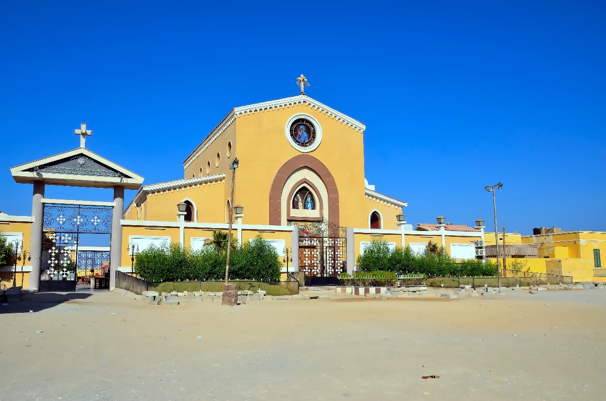
10. The Coptic Church of the Blessed Virgin Mary
maudanros/Shutterstock.com
high fliers/Shutterstock.com
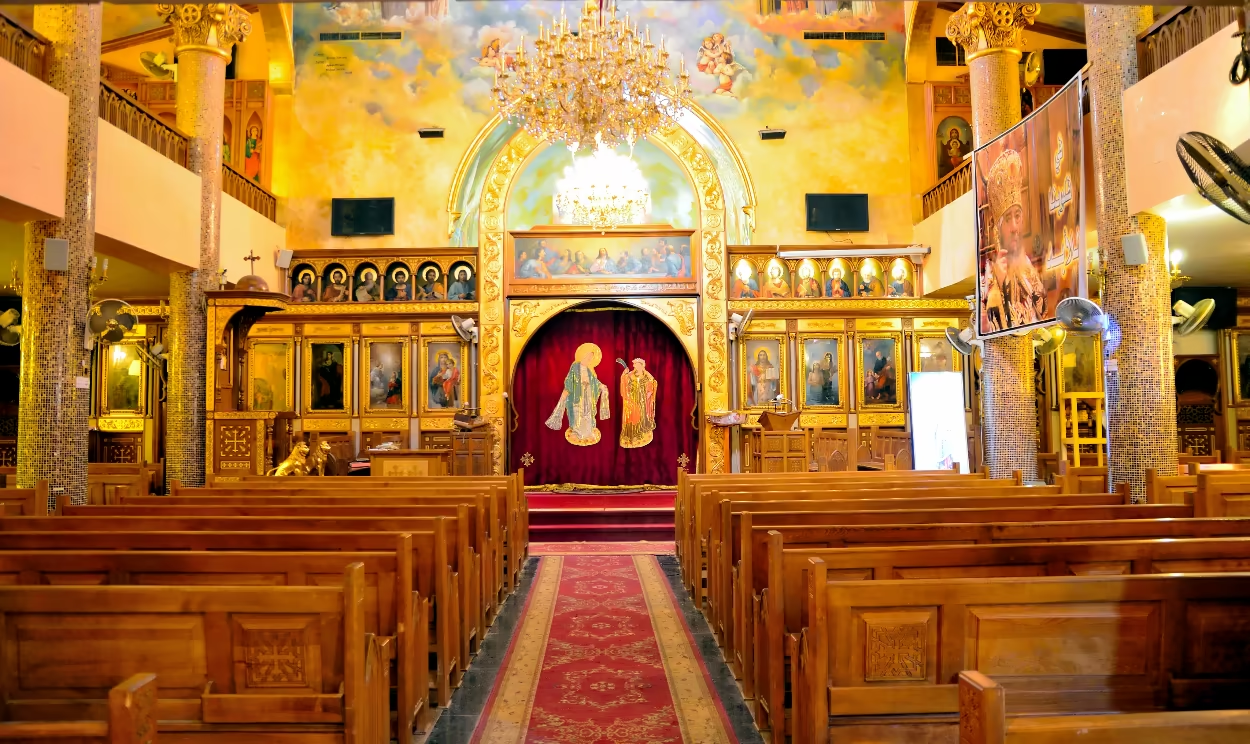
A symbol of El Quseir’s long-standing cultural and religious coexistence, the Coptic Church of the Blessed Virgin Mary has an intriguing history and a strikingly beautiful interior.
Historical Background
The church’s history begins with the Italian Phosphate Company. It was originally built in 1938 as a Catholic Franciscan church, primarily to serve the company’s large Italian workforce. Designed by Riccardo Decima and named after St Barbara, the patron saint of miners, the Franciscan Catholic church stood just a short walking distance to the north of the town centre, located next to a Franciscan Mission building and within a five minute walk of the Phosphate processing plant. Its architecture was an intriguing fusion of styles, combining a gothic arch and rose window with a Byzantine cross crowning the spire.25
Though it was originally a Franciscan Catholic church, its management eventually fell under the jurisdiction of Egypt’s Coptic Church as the local Coptic community grew and the Italian community departed after the company’s nationalization in 1958 by the Egyptian government under President Gamal Abdel Nasser. The exterior of the current church, now called the Church of St. Mary and built on the same location in 2007, closely resembles the original building. The new church is well worth a visit, with its particularly striking and beautiful interior, and its interesting location close to the old abandoned phosphate processing industrial complex (see site 7).
Its Importance Today
Today, the church is celebrated for its beautiful interior, which houses vibrant and richly detailed wall paintings in the modern Coptic iconographic style. It also remains an active and vital place of worship for El Quseir’s Coptic Christian community, which numbers around one thousand people. Its cultural significance is immense, symbolizing the quiet, multicultural identity of El Qusier. Its importance is amplified by its isolation; it is the only Christian church for over 100 kilometers in any direction, serving as the sole spiritual center for Coptic Christians in this vast region of the Red Sea coast.
Book an Exursion
If you are looking to take an excursion to explore the sites of El Quseir, try Steven’s Taxis —run by local expert Steven —and enjoy top-rated service that has earned the business a glowing 4.9 out of 5 score on Tripadvisor (based on 1,104 enthusiastic reviews, as of 28 April 2025). One of his drivers can pick you up from your hotel just after lunch and bring you back after sunset, giving you the whole afternoon to explore.
The round-trip fare is just 60 euros (as of October 2025) for hotels located anywhere between and including Port Ghalib and El Quseir. That works out to at just 20 euros per person when shared between three passengers. If you’re staying south of Port Ghalib or travelling in a group larger than three, just ask for a custom quote.
You can easily save that money and more on the shopping prices in El Quseir which are usually much cheaper than inside the resorts. For more information email steven@marsaalam.com or contact him via WhatsApp on +20 102 999 9978 or by phone on +20 128 433 2337.
Looking for more in depth focused pages including a timeline and fascinating facts about El Quseir:
Looking for another overall general guide to El Quseir including accommadation please read:
Footnotes
- Charles Le Quesne, “Quseir: An Ottoman and Napoleonic Fortress on the Red Sea Coast of Egypt,” The American University in Cairo Press, 2007, p. 18 and 46
- Ibid., Chapter 5.
- “Red Sea: Quseir Fort,” American Research Centre in Egypt.
- Ibid.
- Esraa Mohareb, “Al-Farran Mosque.. The faithful guardian of the Red Sea coast,” 21.09.2025 accessed online at Bab Masr which itself referenced an article by Dr. Mahmoud Al-Tuni “Al-Farran Mosque in Al-Qusayr – An Archaeological Study.”
- Manar Ahmed Al Gammal, “Monitoring Heritage and Urban Change Along the Red Sea: Suez and Quseir as a Case Study,” Thesis for: PhD of Architecture, March 2020, Politecnico di Milano, 1863.
- Ashraf M Salama, “Community Participation and the Housing Process: The Case of an Egyptian City, Quseir.” Al Azhar University Engineering Journal, 4 (Special Issue), 2000 accessed via Academia EU.
- The 2023 study was Maha Elsayed and Kariman Shawky, “Effective Use of Authenticity Value as a Catalyst for Coastal Intermediate Cities Development: A Case of Al-Quseir City, Egypt,” March 2023, p. 17., accessed via Researchgate.net. See also the Tripadv,isor review posted on 14 March 2025.
- Maha Elsayed and Kariman Shawky, Op. cit., p. 17.
- Mohamed Esmat ElAttar and Ahmed Yehia Rashed, “Public Participation in Restoration: A Case Study: Sheikh Tawfik House in Quseir,” accessed via Academia.edu, pp. 16-19.
- Ibid., pp. 21-23.
- Ibid., p. 17 and pp 24-25.
- Peter Graem Earl, Constructed Places: Roman architecture and the mind’s eye. A thesis on the application of spatial theories and computer visualisation to experience an Egyptian Red Sea port around AD 120, 2002, University of Southampton, Doctoral Thesis.
- This claim, both local and historical, is discussed but neither confirmed or refuted by Darren Glazier, ‘We make the diamond shine’ : archaeological communities in Quseir, Egypt.’ 2003, University of Southampton, Doctoral Thesis.
- See for instance Katherine Strange Burke, “The Sheikh’s House at Quseir Al-Qadim: Documenting a Thirteenth Century Red Sea Port,” Oriental Institute Publications, Volume 144, The Oriental Institute of the University of Chicago, 2021 or Darren Glazier, Op. cit.
- Katherine Strange Burke, Op. cit..
- Mirhan Damir et al., “Patterns of Detachment: Spatial Transformations of the Phosphate Industry in El-Quseir, Egypt,” in Urban Planning, January 2023 accessed via ResearchGate.net.
- Ibid.
- The Old Police Station, Lonely Planet.
- Maha M. Elsayed and Kariman A. Shawky, Effective Use of Authenticity Value as a Catalyst for Coastal Intermediate Cities Development: A Case of Al-Quseir City, Egypt, MSA University Engineering Journal, p. 10.
- Darren Glazier, Op. cit., and Maha M. Elsayed and Kariman A. Shawky, Op. cit., p. 10.
- Maha M. Elsayed and Kariman A. Shawky, Op. cit., p. 10.
- James Bruce, Travels to discover the source of the Nile, in the years 1768, 1769, 1770, 1771, 1772, and 1773, G. G. J. and J. Robinson, London, p. 189, accessed via the Internet Archive.
- Manar Ahmed Algammal, Op. cit..
- Antonella Cabassi, “Kossier, a Phosphate-shipping Town,” in Claudine Piaton et al, Building Beyond The Mediterranean. Studying The Archives of European Businesses (1860-1970), OpenEdition Books: March 2, 2021 pp. 104-117, section 24, accessed via OpenEdition Books.